I’ve had a serious itch for a while now to create a trail from scratch. Something with fast descents that hopefully turn out to be a little scarey, a steep climb or two, some tech/rock sections, whilst still being a trail that flows well overall.
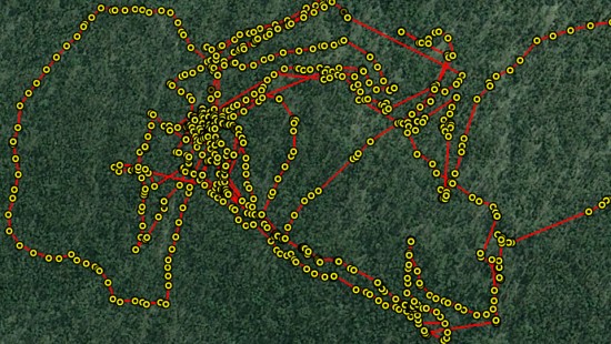
With that in mind there’s a section of bush I’ve spent many hours walking around and thinking about over the last few months. Finally bit the bullet today and started to mark out the first section of ‘Route 44’, based on what I thought was a (rough) plan sketched on a topo map. HA! It proved to be a tricky thing. I ended up in unexpected places and spent a lot of time back tracking to the points of interest along the way, and wandering around generally looking for good lines on a MTB… check out the GPS mess!

It’ll be fun to see how dreadful this first attempt turns out to be when I take the Mojo out to test out the rough lines early next week. My guess is a lot of it will suck pretty badly but that’s part of the process I guess 😛